Annapurna with Tilicho Lake Trek
Journey to the Sacred Waters
17-Day Annapurna with Tilicho Lake Trek
The Annapurna with Tilicho Lake Trek is a 17-day trek starting and finishing in Kathmandu. The high point is 5,416 m. A normal day is 2 to 8 hours of walking. We run it as a private trip on your own dates, or as a small group departure.
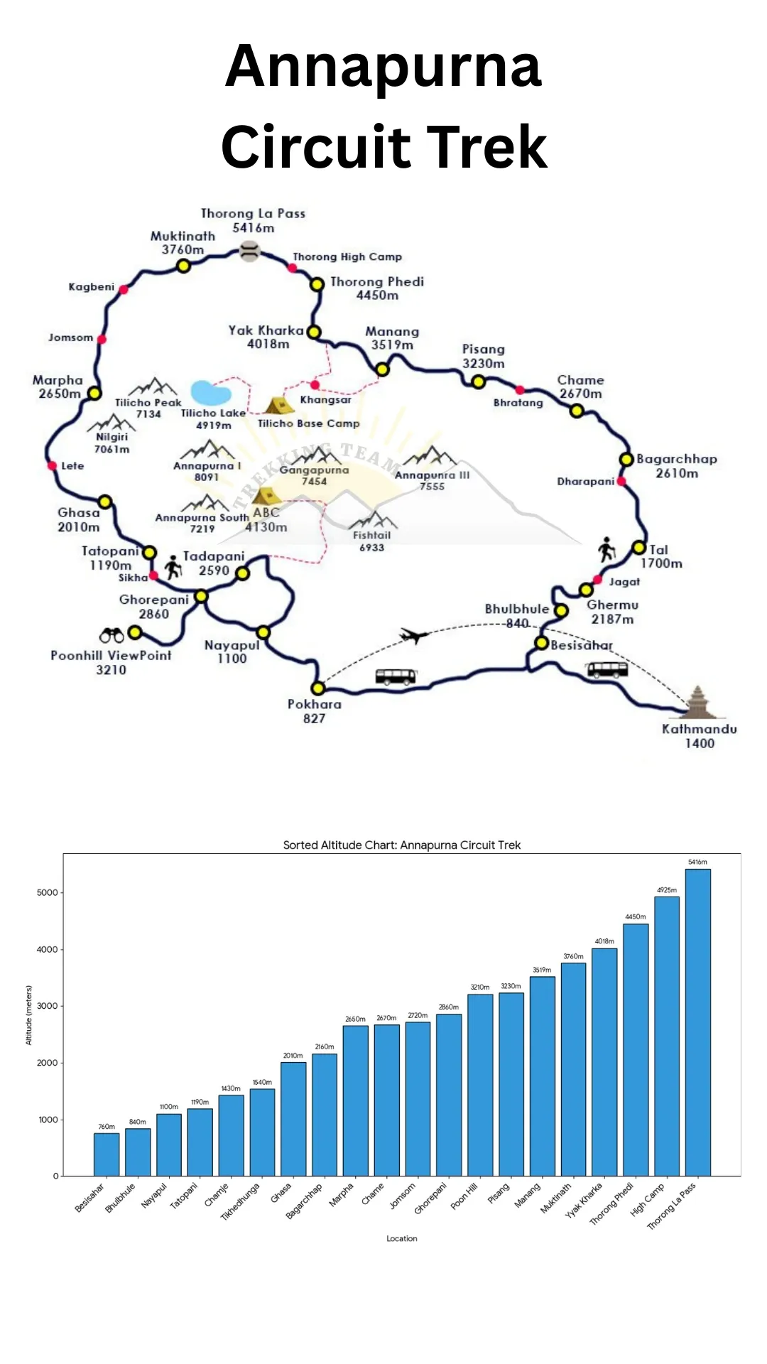
The route runs Chamje, Chame, Pisang, Khangsar, Base Camp, Thorong Phedi, Muktinath and Pokhara. Gurung and Magar in the middle hills, Thakali in the Kali Gandaki, Tibetan Buddhist in Manang and Mustang.
Graded moderate. Nothing on the route is technical, but the altitude is real and it is what decides who finishes. Thorong La at 5,416 m on the Circuit is the serious altitude. The Sanctuary treks top out at 4,130 m and are far more forgiving.
Best time to go. March to May and October to November. Spring is the rhododendron season in the middle hills; autumn gives the sharpest mountain views. The Annapurna region is also the most workable of the big treks in December and January below 3,500 m.
Permits and getting there. Annapurna Conservation Area Project (ACAP) permit and a TIMS card, both included and issued in Kathmandu or Pokhara before you start. Road access from Pokhara. Tourist bus or private vehicle from Kathmandu to Pokhara is 6 to 8 hours, or a 25-minute flight. Note that in autumn 2026 the Prithvi Highway has suffered landslide damage at Krishnabhir, so we check road status before every departure and switch to flights when needed.
Where you sleep. Some of the best teahouses in Nepal. Attached bathrooms and hot showers are common as far as Chhomrong and Manang; above that, twin rooms with shared facilities.
Why book with us. Trekking Team is a family company in Gongabu, Kathmandu, running trips since 1991 under TAAN licence 1106. About ten thousand people have travelled with us and we hold more than 630 TripAdvisor reviews. Every departure runs with a government-licensed guide, permits arranged before you arrive, insured and equipped staff, and a fixed price. If the dates or the route do not suit you, write to us and we will rebuild the itinerary around what you want.
Trip Summary
Duration
Difficulty
Max Elevation
Start point
End point
Daily Activity
Group Size
Best Season
Trip Outline
- Day 1Arrival in Kathmandu
- Day 2Kathmandu: Sightseeing and Trek Preparation
- Day 3Drive from Kathmandu to Chamje (1,410 m)
- Day 4Trek from Chamje to Dharapani (1,930 m)
- Day 5Trek from Dharapani to Chame (2,710 m)
- Day 6Trek from Chame to Pisang (3,300 m)
- Day 7Trek from Pisang to Manang (3,519 m)
- Day 8Trek from Manang to Khangsar (3,745 m)
- Day 9Trek from Khangsar to Tilicho Base Camp (4,140 m)
- Day 10Visit Tilicho Lake (4,919 m), Return to Base Camp
- Day 11Trek from Tilicho Base Camp to Yak Kharka (4,110 m)
- Day 12Trek from Yak Kharka to Thorong Phedi (4,420 m)
- Day 13Thorong La Pass (5,416 m) to Muktinath (3,760 m)
- Day 14Trek from Muktinath to Jomsom (2,700 m)
- Day 15Fly from Jomsom to Pokhara (827 m)
- Day 16Fly from Pokhara to Kathmandu (1,400 m)
- Day 17Final Departure
Included
- Airport pick-up and drop-off in a private vehicle
- Kathmandu to Pokhara and back by tourist coach or by air, plus private vehicle between Pokhara and the trailhead
- Annapurna Conservation Area (ACAP) permit and TIMS card
- Government-licensed, first-aid trained trekking guide, paid, insured and equipped by us
- Porter support, one porter between two trekkers, carrying up to 20 kg, insured and issued boots, jacket and shelter
- Teahouse accommodation on trek, twin share, booked ahead in the peak weeks
- Hotel in Kathmandu on a bed and breakfast basis, as listed in the itinerary
- Down jacket, four-season sleeping bag and duffel bag on free loan for the trek
- Route map, trip completion certificate and a farewell dinner in Kathmandu
- Staff wages, insurance, meals, accommodation and equipment
- All government taxes, VAT and company service charges
- Secure storage for the luggage you leave in Kathmandu
Not Included
- International flights and the Nepal visa fee
- Meals on trek. Our packages run on a bed and breakfast basis: add a prepaid meal plan when you book, or pay the teahouses directly as you go
- Lunches and dinners in Kathmandu
- Travel insurance covering medical treatment, helicopter evacuation and repatriation. This is compulsory and we need your policy details before departure
- Personal trekking clothing and equipment
- Drinks of any kind: bottled water, soft drinks, alcohol and hot drinks
- Hot showers, battery charging, wifi and hot water bottles at the lodges
- Supplementary oxygen, which is always an optional extra
- Extra nights in Kathmandu, and any cost arising from an early return, a flight delay or a change of itinerary caused by weather or illness
- Emergency helicopter evacuation, which your insurance must cover
- Tips for your guide, porters and drivers
- Anything not listed under what is included
Get started on your journey
Detailed itinerary
Arrival in Kathmandu
Met at Tribhuvan International Airport and transferred to your hotel. Evening welcome dinner and a full briefing. This itinerary combines the Annapurna Circuit with the side trip to Tilicho Lake at 4,919 m, so the acclimatisation plan matters more than usual and we go through it in detail.
Altitude: 1,400 m.
Travel duration
Elevation
Meal
Accommodation
Kathmandu: Sightseeing and Trek Preparation
Guided sightseeing at Boudhanath, Pashupatinath and Swayambhunath, then permits and a gear check in the afternoon, with time in Thamel for anything missing.
Walking: 3 to 4 hours of sightseeing.
Travel duration
Elevation
Meal
Accommodation
Drive from Kathmandu to Chamje (1,410 m)
West along the Prithvi Highway to Besisahar, then north up the Marsyangdi valley by jeep on a rough road that follows the river into the hills. Chamje is a small village beside a waterfall where the valley starts to narrow.
Drive: 8 to 9 hours. Altitude gain: 10 m net by vehicle.
Travel duration
Elevation
Meal
Accommodation
Trek from Chamje to Dharapani (1,930 m)
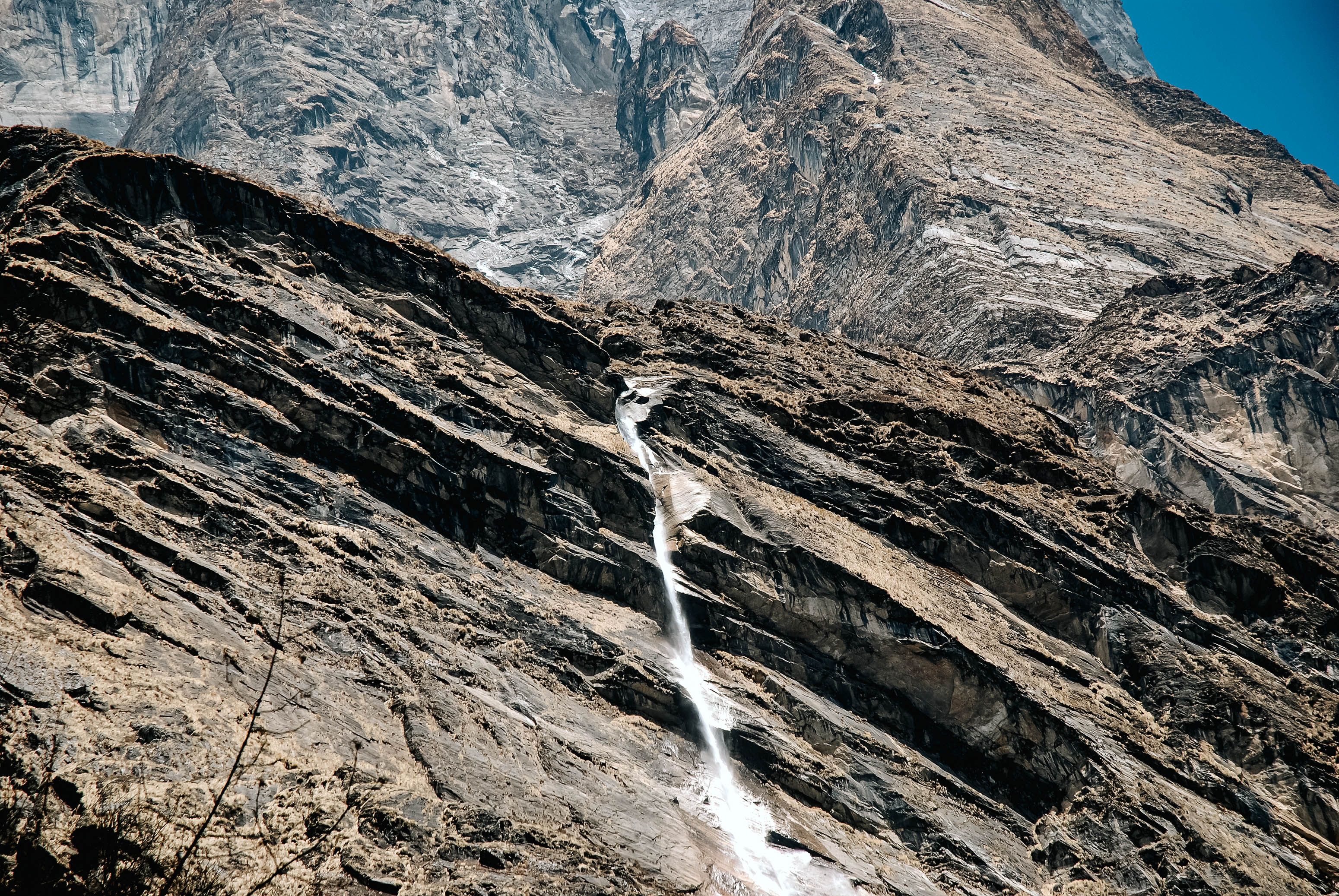
The walking begins. The trail follows the Marsyangdi through a steep-sided gorge, crossing and recrossing the river on suspension bridges, past Tal, a village on a flat sandy riverbed that was once a lake. The valley here is subtropical and warm, with waterfalls on both walls.
Dharapani is where the Manaslu Circuit joins the Annapurna Circuit from the north.
Distance: 15 km. Walking: 5 to 6 hours. Altitude gain: 520 m.
Travel duration
Elevation
Meal
Accommodation
Trek from Dharapani to Chame (2,710 m)
Through Bagarchhap and Danaque, where the trail steepens, and up to Timang with the first view of Manaslu, the eighth highest mountain in the world, behind you. The forest changes from subtropical to pine as you climb.
Chame is the administrative headquarters of Manang district, with a police checkpoint, shops and hot springs by the river.
Distance: 16 km. Walking: 5 to 6 hours. Altitude gain: 780 m.
Travel duration
Elevation
Meal
Accommodation
Trek from Chame to Pisang (3,300 m)
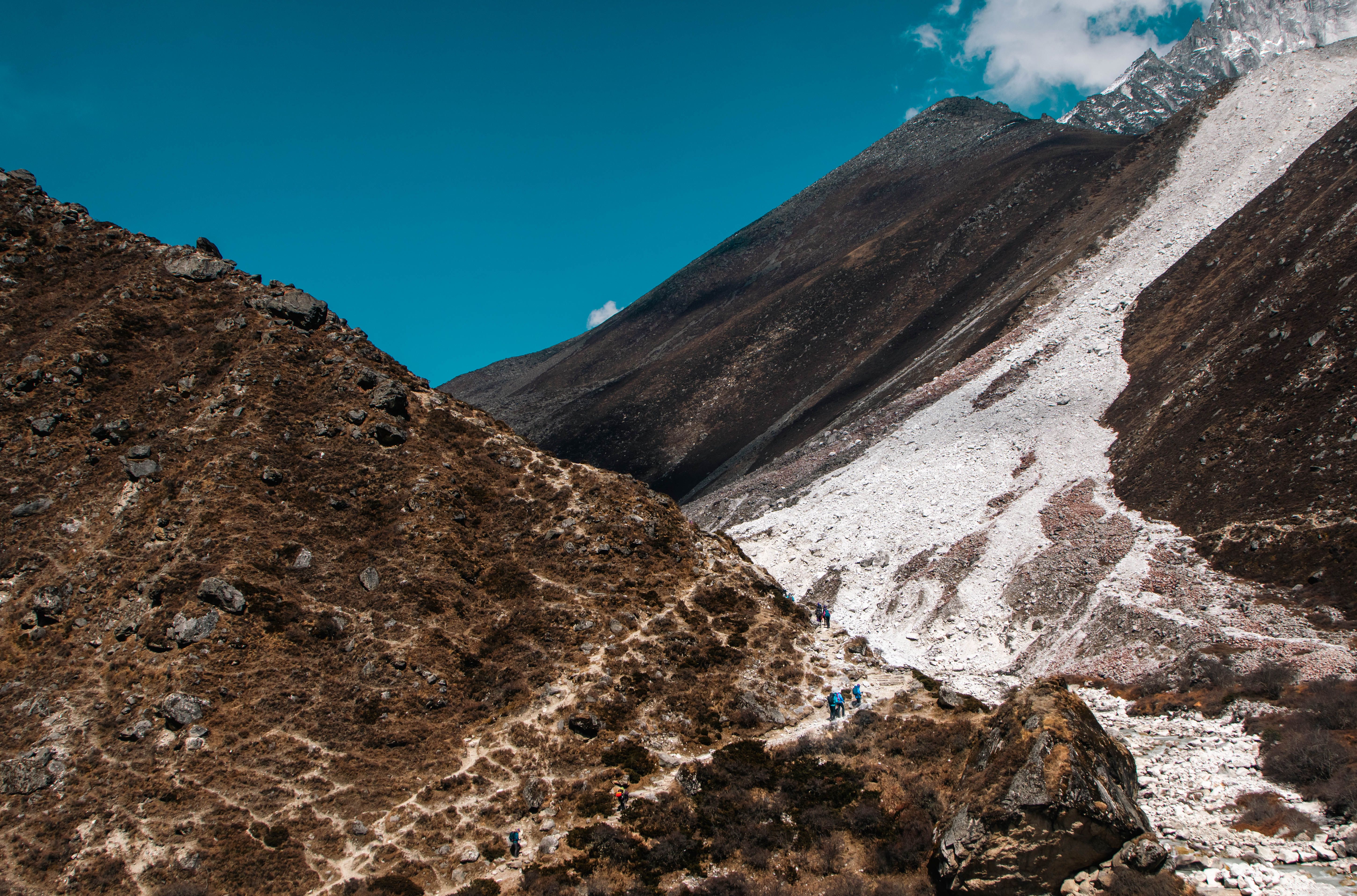
The valley narrows dramatically. Through pine forest to Bhratang, then across to the north bank for the walk beneath the Paungda Danda, a curved rock slab rising 1,500 m straight out of the river, which is one of the most extraordinary sights on the circuit.
The last hour climbs to Pisang, with Annapurna II and IV across the valley.
Distance: 14 km. Walking: 5 to 6 hours. Altitude gain: 590 m.
Travel duration
Elevation
Meal
Accommodation
Trek from Pisang to Manang (3,519 m)
We take the high route through Ghyaru and Ngawal rather than the valley floor. It costs an extra 400 m of climbing and two hours, and repays both: medieval stone villages on the hillside, and the whole Annapurna range across the valley from Annapurna II through Gangapurna to Tilicho Peak.
The descent runs through Braga, where the 500-year-old gompa is built into the cliff, into Manang.
Distance: 16 km. Walking: 6 to 7 hours. Altitude gain: 220 m net, with 400 m of climbing.
Travel duration
Elevation
Meal
Accommodation
Trek from Manang to Khangsar (3,745 m)
A short, gentle day that turns off the main circuit into the Khangsar valley, heading west towards Tilicho. Khangsar is the last village on this side, a small Tibetan-influenced settlement with a gompa above it.
The half day is deliberate: it is good acclimatisation and it positions you for the long walk to Tilicho Base Camp tomorrow.
Distance: 6 km. Walking: 2 to 3 hours. Altitude gain: 226 m.
Travel duration
Elevation
Meal
Accommodation
Trek from Khangsar to Tilicho Base Camp (4,140 m)
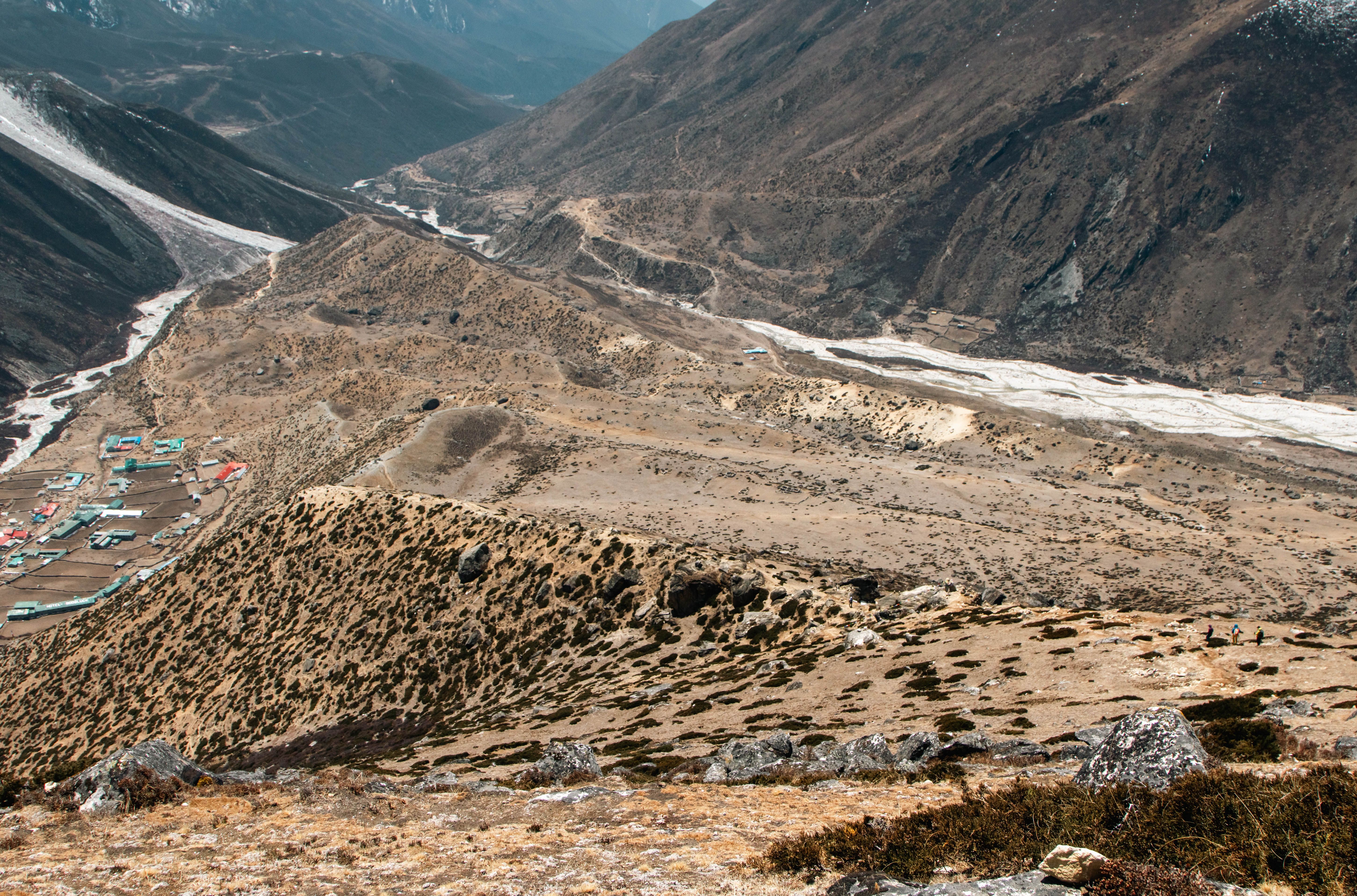
The most exposed walking of the trek. Beyond the ruined Tare Gumba the trail traverses a long stretch of steep, unstable scree slopes above the Khangsar Khola, a section that requires care and steady footing; there is loose rock above and a long drop below, and it is genuinely not the place to hurry.
Tilicho Base Camp is a cluster of lodges on a shelf beneath the moraine at 4,140 m. Cold, exposed and spectacular.
Distance: 10 km. Walking: 5 to 6 hours. Altitude gain: 395 m.
Travel duration
Elevation
Meal
Accommodation
Visit Tilicho Lake (4,919 m), Return to Base Camp
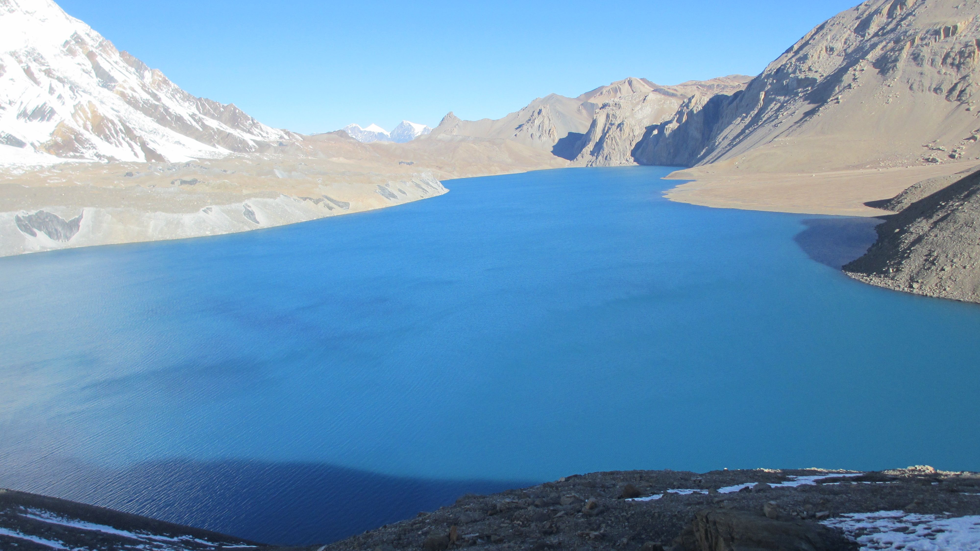
A very early start for the 900 m climb to Tilicho Lake, one of the highest large lakes in the world at 4,919 m. The trail switchbacks up a steep moraine slope for three to four hours, and the last section is often snow-covered.
The lake sits in a bare, wind-scoured basin beneath the Grand Barrier, a 7,000 m wall of ice and rock, and it is frozen for much of the year. There is no shelter and the wind is fierce, so most groups spend twenty minutes there and start down.
Back at Base Camp by mid-afternoon.
Distance: 12 km round trip. Walking: 5 to 6 hours. Altitude: up 779 m and back down.
Travel duration
Elevation
Meal
Accommodation
Trek from Tilicho Base Camp to Yak Kharka (4,110 m)
Back across the scree traverse in the morning when the ground is firmest, then a route over the Khangsar ridge that rejoins the main circuit trail without returning all the way to Manang.
Yak Kharka is a small cluster of lodges in open pasture with blue sheep on the slopes above. You are now well acclimatised for the pass, which is the whole advantage of doing Tilicho first.
Distance: 14 km. Walking: 4 to 5 hours. Altitude loss: 30 m net.
Travel duration
Elevation
Meal
Accommodation
Trek from Yak Kharka to Thorong Phedi (4,420 m)
A short day by design. The trail climbs to Ledar, crosses the river and traverses a loose scree slope where care is needed, then climbs to Thorong Phedi at the foot of the pass.
Early dinner and an early night. Your guide will decide this afternoon whether the group sleeps here or pushes the extra hour to High Camp at 4,880 m.
Distance: 7 km. Walking: 3 to 4 hours. Altitude gain: 310 m.
Travel duration
Elevation
Meal
Accommodation
Thorong La Pass (5,416 m) to Muktinath (3,760 m)
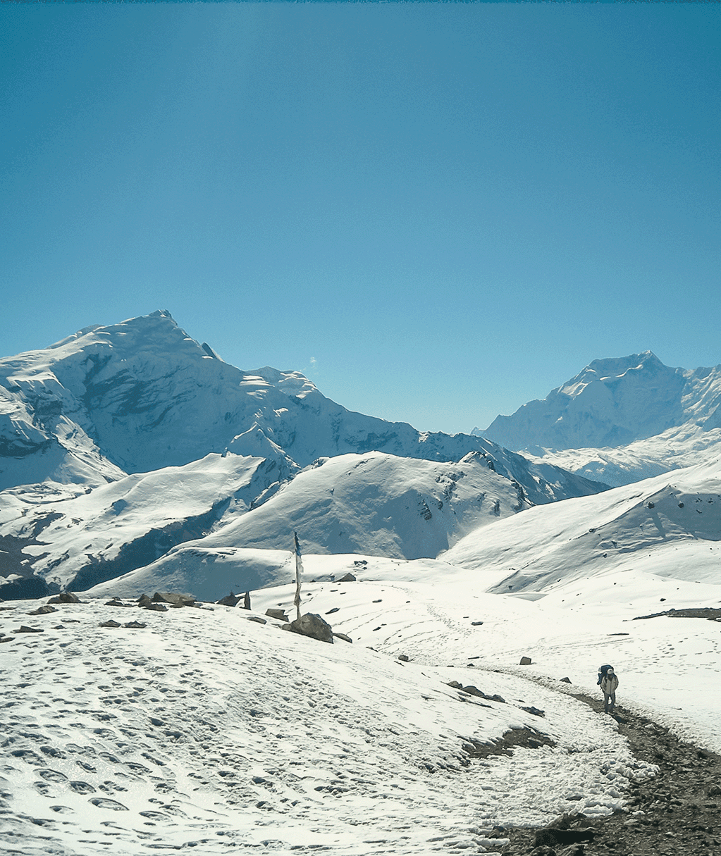
The big day. Away between 4 and 5 am by headlamp to reach the pass before the wind gets up. An hour to High Camp, then four hours of switchbacks and false summits to the prayer flags at Thorong La, 5,416 m, with the Annapurnas behind and Dhaulagiri and the Mustang desert ahead.
The descent is 1,650 m over four hours and is harder on the legs than the climb. Muktinath at the bottom is sacred to both Hindus and Buddhists, with 108 water spouts and an eternal flame fed by natural gas.
Distance: 15 km. Walking: 7 to 8 hours. Altitude: up 996 m, then down 1,656 m.
Travel duration
Elevation
Meal
Accommodation
Trek from Muktinath to Jomsom (2,700 m)
Temple visit in the morning, then the descent into the Kali Gandaki through the desert villages of Jharkot and Khingar to Kagbeni, the medieval settlement at the gateway to Upper Mustang, with its red gompa and tunnelled alleys.
From Kagbeni the trail follows the wide riverbed to Jomsom. The valley wind here is famous and blows hard from late morning, so we walk early.
Distance: 18 km. Walking: 5 to 6 hours. Altitude loss: 1,060 m.
Travel duration
Elevation
Meal
Accommodation
Fly from Jomsom to Pokhara (827 m)
An early morning flight through the Kali Gandaki gorge between Annapurna and Dhaulagiri, twenty minutes and one of the most dramatic short flights in Nepal. Flights only operate in the morning before the wind rises and are cancelled in poor visibility; if that happens we drive, which takes most of the day.
Afternoon free in Pokhara on Lakeside.
Flight: 20 minutes.
Travel duration
Elevation
Meal
Accommodation
Fly from Pokhara to Kathmandu (1,400 m)
A 25-minute flight back to Kathmandu along the Himalayan chain. Afternoon free for shopping in Thamel, farewell dinner with the team in the evening.
Flight: 25 minutes.
Travel duration
Elevation
Meal
Accommodation
Final Departure
Transfer to Tribhuvan International Airport about three hours before your flight, or onward arrangements if you are extending your stay in Nepal, Bhutan or Tibet.
Travel duration
Elevation
Meal
Accommodation
Getting ready
Two to three months of preparation makes the difference between enduring this trip and enjoying it. Walk hills, not treadmills. Build to a five or six hour day with a 7 kg pack, twice a week, and add a back-to-back weekend so your legs learn what consecutive days feel like. Stairs with a loaded pack are the best substitute if you live somewhere flat.
Break in your boots properly. More trips are ruined by new footwear than by altitude.
Altitude and acclimatisation
The high point on this trip is 5,416 m. Thorong La at 5,416 m on the Circuit is the serious altitude. The Sanctuary treks top out at 4,130 m and are far more forgiving.
Rules we work to: gain no more than 400 to 500 m of sleeping altitude a day above 3,000 m, take a rest day roughly every 1,000 m, climb high and sleep low on those days, drink three to four litres daily, and skip alcohol and sleeping tablets above 3,500 m. Your guide carries a pulse oximeter and a first aid kit and records the group morning and evening.
Diamox (acetazolamide) is a legitimate aid, not a shortcut, and works best started 24 hours before you go high. Discuss it with your own doctor before you travel; we do not prescribe.
If anyone deteriorates, the answer is descent, immediately and without debate. Our guides have the authority to turn a client around and they use it.
Permits and paperwork
Annapurna Conservation Area Project (ACAP) permit and a TIMS card, both included and issued in Kathmandu or Pokhara before you start.
Nepal issues visas on arrival at Tribhuvan International Airport: 15, 30 or 90 days, payable in cash in most major currencies or by card. Bring two passport photographs and make sure your passport has at least six months validity.
Money, tipping and costs on the ground
Nepali rupees are the only currency accepted on the trail. Draw cash in Kathmandu or Pokhara before you leave; ATMs have a per-transaction limit of around NPR 35,000 and charge a fee, and above the roadhead there are no machines and no card terminals.
Budget roughly USD 10 to 20 a day for drinks, snacks, hot showers, charging and wifi that are not in the price. Bottled water is best avoided for both cost and plastic reasons.
Tipping is customary and genuinely matters to the crew, but it is not compulsory and never demanded. As a guide to the guide: around USD 8 to 12 per day for your trekking guide and USD 6 to 8 for each porter, pooled by the group and handed over at the end.
Staying in touch
Wi-Fi in most lodges, mobile signal along much of the route, and mains charging at low cost.
Ncell and Nepal Telecom tourist SIM cards are sold at Kathmandu airport and take about ten minutes. Bring your passport.
What to pack
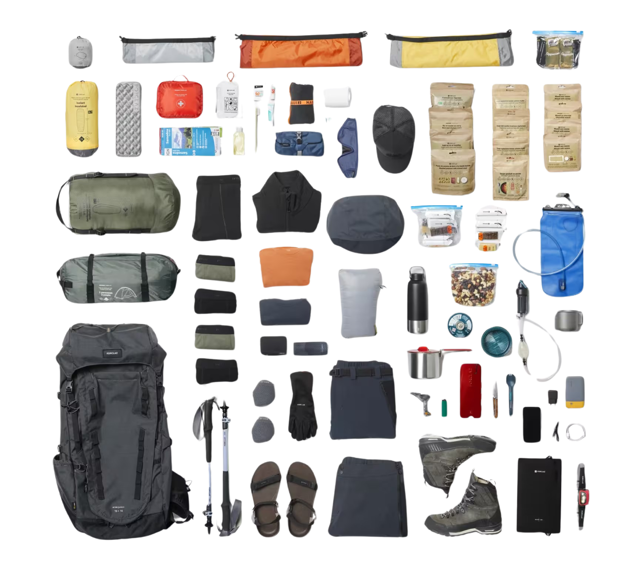
We send a full checklist when you book. The items people most often get wrong:
- Broken-in boots with ankle support, plus trainers or sandals for the evenings
- A four-season down sleeping bag rated to at least minus 10 C, and a down jacket. We lend both at no charge if you would rather not buy them
- Layers rather than bulk: thermal base, fleece, windproof shell, waterproof jacket and trousers
- Sun hat, warm hat, glove liners and warm gloves, and category 4 sunglasses. Snow glare at altitude is brutal
- A one-litre bottle plus a two-litre bladder, and a SteriPen or chlorine tablets so you can refill instead of buying plastic
- Personal first aid: blister plasters, ibuprofen, rehydration salts, antiseptic, any prescriptions in original packaging
- A 20,000 mAh power bank, headtorch with spare batteries, and a two-pin European plug adapter
Health and safety
No vaccinations are legally required for Nepal, but hepatitis A, typhoid and tetanus are sensible and a rabies course is worth discussing if you are travelling for a long time. Check with a travel clinic six to eight weeks before you fly.
Drink treated water rather than bottled where you can, wash hands before every meal, and eat what is freshly cooked. Stomach upsets ruin more trekking days than altitude does.
Our guides carry a comprehensive first aid kit, a pulse oximeter and, on the higher routes, supplementary oxygen. We hold a 24-hour operations line in Kathmandu throughout your trip, and we run rescue coordination ourselves rather than handing it to a third party.
Responsible trekking
We pay porters above the TAAN minimum, insure every member of staff, cap load weights and provide boots, jackets and shelter at altitude. That is not a marketing line; it is the reason our crew come back season after season and some have been with the family for twenty years.
On the trail: carry your rubbish out, use refill points instead of plastic bottles, ask before photographing people, walk clockwise around mani walls and chortens, and give way to loaded yaks on the mountain side of the path, not the drop side.
Booking and cancellation
A deposit confirms your dates and the balance is due before departure. If your plans change we will move your booking to another date rather than treat it as a cancellation wherever the ground operators allow it.
Written quotes are fixed. We do not add fuel or permit surcharges after you have booked, and if a government fee rises between your booking and your departure we absorb it.
Questions before you commit are welcome and never rushed. Write to us with what you actually want and we will tell you plainly whether this trip is the right one, including when the answer is that a different route would suit you better.
Ready to start your journey?
Start planning your dream trip today. Enquire now for more information or customize this trip to tailor it to your needs and make it truly unforgettable.