Lower Dolpo Trek
17 days over Numa La and Baga La, through Dho Tarap to Phoksundo Lake
17-Day Lower Dolpo Trek
The Lower Dolpo Trek is a 17-day trip starting and finishing in Kathmandu. The high point is Numa La at 5,190 m and a normal day is 5 to 7 hours of walking. It is a mixed teahouse and camping trek, and the camping section is not optional: there are no lodges in the upper Tarap gorge.
The route goes in the hard way and comes out the easy way. From Dunai you turn east up the Thuli Bheri and climb the Tarap Khola gorge for three days to reach Dho Tarap at 4,090 m, one of the highest inhabited valleys anywhere. Then you cross Numa La and Baga La back to back and drop to Phoksundo Lake.
Dho Tarap is the reason to do this trek rather than the Phoksundo one. It is a working Tibetan-culture valley where Bon and Buddhist families farm barley at 4,000 m, not a viewpoint. Two days there changes how the rest of the walk reads.
Two passes over 5,000 m in consecutive days, four nights above 4,000 m and a camping section with no bail-out make this a serious undertaking. Good general fitness is not enough on its own; you want recent multi-day experience at altitude.
Trip Summary
Duration
Difficulty
Max Elevation
Start point
End point
Daily Activity
Group Size
Best Season
Trip Outline
- Day 1Arrival in Kathmandu
- Day 2Kathmandu to Nepalgunj
- Day 3Fly to Juphal and trek to Dunai
- Day 4Dunai to Tarakot
- Day 5Tarakot to Laini Odar
- Day 6Laini Odar to Nawarpani
- Day 7Nawarpani to Dho Tarap
- Day 8Acclimatisation day at Dho Tarap
- Day 9Dho Tarap to Numa La Base Camp
- Day 10Cross Numa La to Pelung Tang
- Day 11Cross Baga La to Dajok Tang
- Day 12Dajok Tang to Ringmo and Phoksundo Lake
- Day 13Phoksundo Lake
- Day 14Ringmo to Chhepka
- Day 15Chhepka to Juphal
- Day 16Fly Juphal to Nepalgunj and on to Kathmandu
- Day 17Departure
Included
- Teahouse accommodation on the lower sections and a full camping setup on the Tarap and pass sections
- All meals on the trek, breakfast, lunch and dinner, cooked by our own kitchen crew on the camping sections
- Two-person tents, dining tent, kitchen tent, toilet tent, mattresses and all camp equipment
- Cook and kitchen crew, pack animals or porters for camp loads
- Lower Dolpo restricted area permit and Shey Phoksundo National Park entry fee
- Airport pick-up and drop-off in a private vehicle
- Kathmandu hotel on bed and breakfast basis
- Kathmandu to Nepalgunj and Nepalgunj to Juphal flights, and the return
- One night in Nepalgunj with breakfast on the outbound leg
- All restricted area permits and national park entry fees
- Government-licensed English-speaking guide, a long-term team member rather than a freelancer
- Porters or pack animals for your duffel, with their insurance, wages, food and equipment
- Staff insurance, domestic flights and transfers for the crew
- Comprehensive first aid kit, pulse oximeter and a satellite communication device carried by the guide
- Trekking Team duffel bag and route map
- All government and local taxes
Not Included
- International flights to and from Kathmandu
- Nepal visa, available on arrival at Kathmandu airport
- Travel insurance, which must cover helicopter evacuation above 5,000 m and is compulsory on this trip
- Lunches and dinners in Kathmandu and Nepalgunj
- Personal trekking equipment, sleeping bag and down jacket, both available to rent in Kathmandu
- Supplementary oxygen, which is always an extra and never included
- Drinks, snacks bought on the trail, hot showers and device charging
- Tips for the guide and crew
- Any cost arising from a flight delay, early return or evacuation
Get started on your journey
Detailed itinerary
Arrival in Kathmandu
Met at the airport and transferred to your hotel, with a briefing and kit check in the evening.
Altitude: 1,400 m.
Travel duration
Elevation
Meal
Accommodation
Kathmandu to Nepalgunj
Fly southwest to the Terai and overnight near the airport for the early Juphal departure. Repack here for the weight limit on the small aircraft.
Altitude: 150 m. Flight: about 1 hour.
Travel duration
Elevation
Meal
Accommodation
Fly to Juphal and trek to Dunai
A thirty five minute flight into the Bheri gorge and a landing at Juphal, then down through terraces to the river and upstream to Dunai.
Altitude: 2,140 m. Distance: 4 km. Walking: 2 to 3 hours.
Travel duration
Elevation
Meal
Accommodation
Dunai to Tarakot
East now, away from the Phoksundo trail and up the Thuli Bheri on a path cut into the hillside above the water. Tarakot sits on a spur with an old fort above it, the seat of the local rulers before Dolpa came under Kathmandu.
Altitude: 2,540 m. Distance: 13 km. Walking: 5 to 6 hours.
Travel duration
Elevation
Meal
Accommodation
Tarakot to Laini Odar
The trail turns up the Tarap Khola and the gorge closes in. You cross and recross the river on timber bridges and the climb becomes serious, more than 800 m of gain over the day.
From here the teahouses run out. This is where the camping section of the trek begins and the crew sets up the kitchen tent for the first time.
Altitude: 3,375 m. Distance: 12 km. Walking: 5 to 6 hours.
Travel duration
Elevation
Meal
Accommodation
Laini Odar to Nawarpani
A hard day in a narrow gorge, with exposed sections where the path has been built out from the cliff on stacked stone. The Tarap Khola is loud and close the whole way.
Altitude: 3,950 m. Distance: 11 km. Walking: 6 to 7 hours.
Travel duration
Elevation
Meal
Accommodation
Nawarpani to Dho Tarap
The gorge finally opens into the Tarap valley, a wide flat-bottomed basin of barley fields and stone-walled paddocks that feels like Tibet because it effectively is.
Dho Tarap is one of the highest permanently inhabited valleys in the world. Bon and Buddhist households live side by side here and both gompas are worth the walk.
Altitude: 4,090 m. Distance: 14 km. Walking: 6 to 7 hours.
Travel duration
Elevation
Meal
Accommodation
Acclimatisation day at Dho Tarap
A day to let your body catch up before the passes. We walk up to Ribo Bhumpa or Shipchhok gompa in the morning, a few hundred metres of gain, then come back down to sleep.
Climbing high and sleeping low is the whole point of this day. Use it. The two passes ahead are both over 5,000 m and they come back to back.
Altitude: 4,090 m. Walking: 3 to 4 hours.
Travel duration
Elevation
Meal
Accommodation
Dho Tarap to Numa La Base Camp
A short, steady climb up the upper Tarap valley past Tokyu gompa to a camp below the pass. Yak pastures, almost no trees, and a lot of sky.
An early night. Tomorrow is the biggest day of the trek.
Altitude: 4,440 m. Distance: 9 km. Walking: 5 to 6 hours.
Travel duration
Elevation
Meal
Accommodation
Cross Numa La to Pelung Tang
Up before light for the long pull to Numa La at 5,190 m, the high point of the trek. From the top, on a clear morning, Dhaulagiri stands up to the southeast and the whole Tarap system falls away behind you.
The descent on the far side is loose and long. It is a seven hour day and it earns its reputation.
Altitude: 4,465 m. Pass: Numa La, 5,190 m. Distance: 13 km. Walking: 7 to 8 hours.
Travel duration
Elevation
Meal
Accommodation
Cross Baga La to Dajok Tang
A second pass, Baga La at 5,070 m, lower than yesterday but coming on tired legs. The climb is about 600 m and takes most of the morning.
From the top the ground drops away west towards the Phoksundo side of the massif. The camp at Dajok Tang is in a sheltered hollow below the snow line.
Altitude: 4,080 m. Pass: Baga La, 5,070 m. Distance: 12 km. Walking: 6 to 7 hours.
Travel duration
Elevation
Meal
Accommodation
Dajok Tang to Ringmo and Phoksundo Lake
Down through juniper and birch to the lake. After four days above 4,000 m the air at Ringmo feels generous.
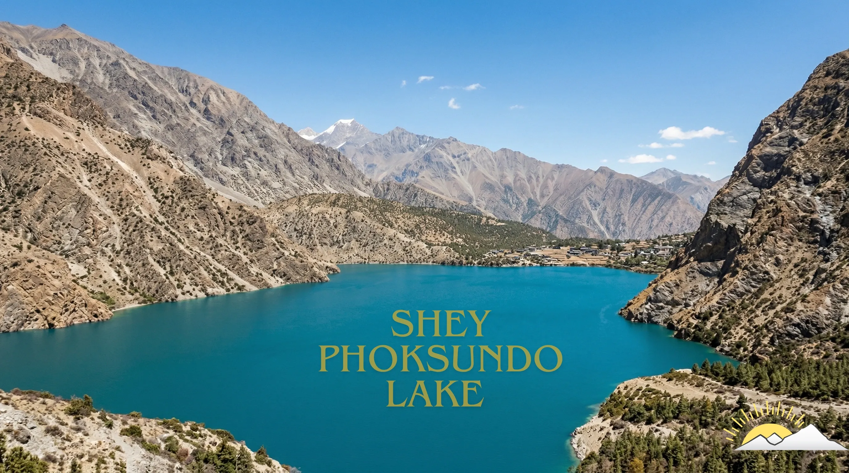
The first sight of Phoksundo from this side, coming down rather than up, is one of the better arrivals in Nepal.
Altitude: 3,640 m. Distance: 11 km. Walking: 4 to 5 hours.
Travel duration
Elevation
Meal
Accommodation
Phoksundo Lake
A full day at the lake: the cliff path on the western shore, the Bon monastery at the far end, or the waterfall at the outlet.
Altitude: 3,640 m. Walking: 2 to 4 hours.
Travel duration
Elevation
Meal
Accommodation
Ringmo to Chhepka
Over the ridge for a last look at the water, then the long descent of the Suli Gad.
Altitude: 2,670 m. Distance: 19 km. Walking: 6 hours.
Travel duration
Elevation
Meal
Accommodation
Chhepka to Juphal
Down the gorge, across the Thuli Bheri and up the last climb to the airstrip.
Altitude: 2,475 m. Distance: 17 km. Walking: 6 to 7 hours.
Travel duration
Elevation
Meal
Accommodation
Fly Juphal to Nepalgunj and on to Kathmandu
Morning flight out, connection to Kathmandu, and a hotel room with a hot shower.
Altitude: 1,400 m.
Travel duration
Elevation
Meal
Accommodation
Departure
Transfer to the airport for your flight home.
Altitude: 1,400 m.
Travel duration
Elevation
Meal
Accommodation
Ready to start your journey?
Start planning your dream trip today. Enquire now for more information or customize this trip to tailor it to your needs and make it truly unforgettable.