Upper Dolpo to Jomsom Trek
28 days across the full Dolpo traverse, over seven passes to the Kali Gandaki
28-Day Upper Dolpo to Jomsom Trek
The Upper Dolpo to Jomsom Trek is a 28-day traverse starting in Kathmandu and finishing in Jomsom. The high point is Sangda La at 5,550 m, a normal day is 6 to 8 hours of walking, and it crosses seven passes above 4,400 m. From Phoksundo to Jomsom it is a full camping expedition.
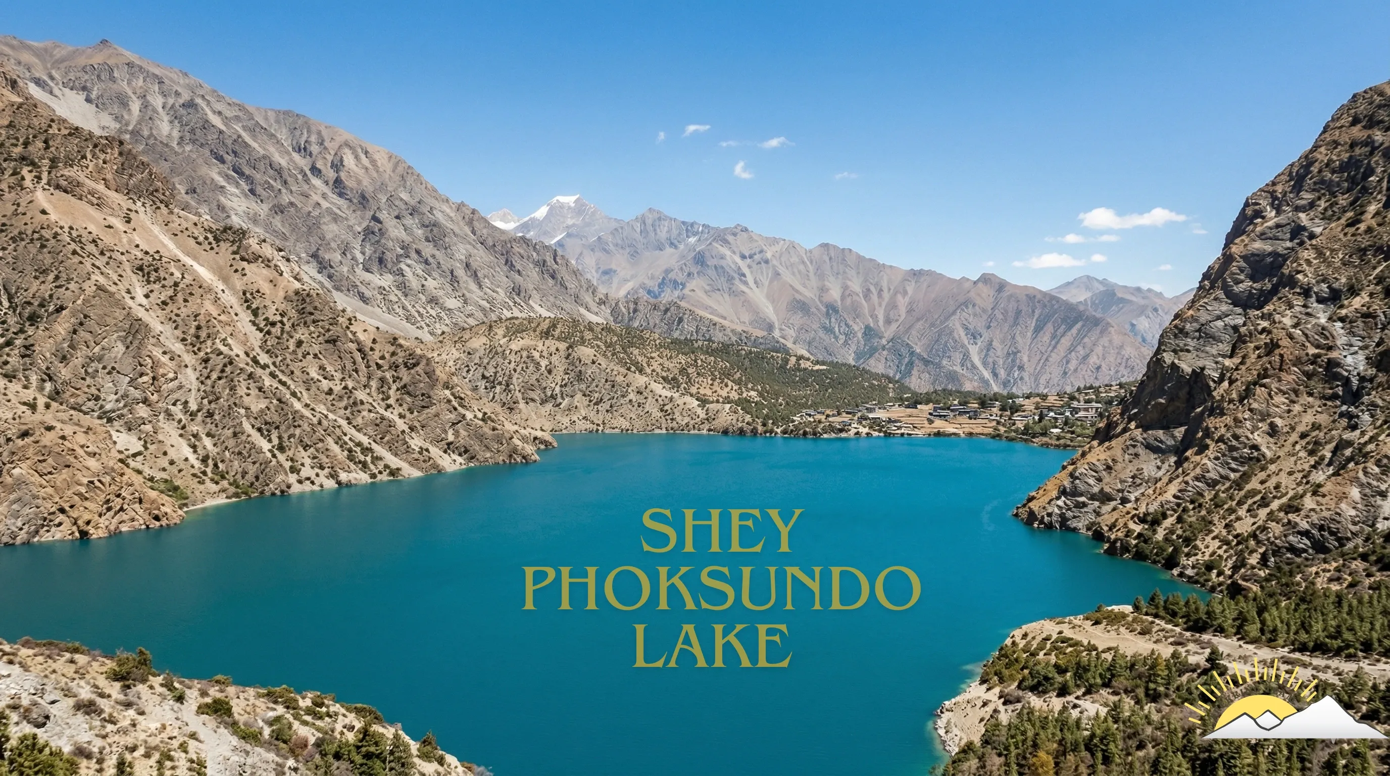
This is the complete crossing. You fly into Juphal at the western end, walk up through Phoksundo to Shey Gompa, work east and north through Namgung, Tinje and Chharka Bhot close to the Tibetan border, then turn south over Niwar La and Sangda La and drop into the Kali Gandaki at Jomsom.
Nothing else in Nepal strings together this much high, dry, Tibetan-culture country in one continuous line. Tinje and Chharka Bhot see a few dozen foreign trekkers a year between them. There are stretches of three and four days with no settlement at all, and the crew carries everything.
Treat this as an expedition rather than a trek. Twenty nights above 3,900 m, two nights near 5,000 m, a day that crosses two 5,000 m passes back to back in the fourth week, and no road anywhere on the route. We run it for small groups with recent Himalayan experience and we are honest with people about whether it suits them.
Trip Summary
Duration
Difficulty
Max Elevation
Start point
End point
Daily Activity
Group Size
Best Season
Trip Outline
- Day 1Arrival in Kathmandu
- Day 2Kathmandu: permits and preparation
- Day 3Kathmandu to Nepalgunj
- Day 4Fly to Juphal and trek to Dunai
- Day 5Dunai to Chhepka
- Day 6Chhepka to Rechi
- Day 7Rechi to Ringmo and Phoksundo Lake
- Day 8Acclimatisation at Phoksundo Lake
- Day 9Ringmo to Phoksundo Khola
- Day 10Phoksundo Khola to Pass Camp
- Day 11Cross Kang La to Shey Gompa
- Day 12Shey Gompa and the Crystal Mountain
- Day 13Cross Shey La to Namgung
- Day 14Namgung to Tora Sumda
- Day 15Tora Sumda to Musi Gaon
- Day 16Cross Musi La to Chanpola
- Day 17Chanpola to Tinje
- Day 18Tinje to Rapka
- Day 19Cross Mola to Chharka Bhot
- Day 20Rest day at Chharka Bhot
- Day 21Chharka Bhot to Molum Sumna
- Day 22Cross Niwar La and Sangda La to Ghalden Khola
- Day 23Ghalden Khola to Sangda
- Day 24Cross Bhima Lojun La to Phalyak
- Day 25Phalyak to Jomsom
- Day 26Fly Jomsom to Pokhara
- Day 27Pokhara to Kathmandu
- Day 28Departure
Included
- Full camping setup from Phoksundo Khola to Jomsom: two-person tents, dining tent, kitchen tent, toilet tent, mattresses and all camp equipment
- All meals on the trek, breakfast, lunch and dinner, cooked by our own kitchen crew
- Cook and full kitchen crew, pack animals and handlers for the whole traverse
- Teahouse accommodation on the Suli Gad section and at Jomsom, twin share
- Upper Dolpo and Lower Dolpo restricted area permits, Shey Phoksundo National Park fee and the Annapurna Conservation Area permit
- Jomsom to Pokhara flight and Pokhara to Kathmandu flight or tourist coach
- One contingency day built into the itinerary at Chharka Bhot
- Airport pick-up and drop-off in a private vehicle
- Kathmandu hotel on bed and breakfast basis
- Kathmandu to Nepalgunj and Nepalgunj to Juphal flights, and the return
- One night in Nepalgunj with breakfast on the outbound leg
- All restricted area permits and national park entry fees
- Government-licensed English-speaking guide, a long-term team member rather than a freelancer
- Porters or pack animals for your duffel, with their insurance, wages, food and equipment
- Staff insurance, domestic flights and transfers for the crew
- Comprehensive first aid kit, pulse oximeter and a satellite communication device carried by the guide
- Trekking Team duffel bag and route map
- All government and local taxes
Not Included
- International flights to and from Kathmandu
- Nepal visa, available on arrival at Kathmandu airport
- Travel insurance, which must cover helicopter evacuation above 5,000 m and is compulsory on this trip
- Lunches and dinners in Kathmandu and Nepalgunj
- Personal trekking equipment, sleeping bag and down jacket, both available to rent in Kathmandu
- Supplementary oxygen, which is always an extra and never included
- Drinks, snacks bought on the trail, hot showers and device charging
- Tips for the guide and crew
- Any cost arising from a flight delay, early return or evacuation
Get started on your journey
Detailed itinerary
Arrival in Kathmandu
Airport transfer and an evening briefing with a full kit check for a four-week camping expedition.
Altitude: 1,400 m.
Travel duration
Elevation
Meal
Accommodation
Kathmandu: permits and preparation
Permit processing with your original passport, and time to hire or buy whatever is missing. This trip needs two restricted area permits and an ACAP permit for the Jomsom end.
Altitude: 1,400 m.
Travel duration
Elevation
Meal
Accommodation
Kathmandu to Nepalgunj
Flight to the Terai, overnight near the airport, final repack for the weight limit.
Altitude: 150 m. Flight: about 1 hour.
Travel duration
Elevation
Meal
Accommodation
Fly to Juphal and trek to Dunai
The small aircraft into the Bheri gorge, then down to the river and up to Dunai.
Altitude: 2,140 m. Walking: 2 to 3 hours.
Travel duration
Elevation
Meal
Accommodation
Dunai to Chhepka
Up the Suli Gad past the park checkpost, climbing gently into the gorge.
Altitude: 2,670 m. Distance: 14 km. Walking: 5 to 6 hours.
Travel duration
Elevation
Meal
Accommodation
Chhepka to Rechi
Steeper ground beside the river, past the waterfall, birch replacing pine.
Altitude: 3,110 m. Distance: 13 km. Walking: 5 to 6 hours.
Travel duration
Elevation
Meal
Accommodation
Rechi to Ringmo and Phoksundo Lake
The spur to the 3,780 m ridge and the first sight of the lake, then down into Ringmo.
Altitude: 3,640 m. Walking: 4 to 5 hours.
Travel duration
Elevation
Meal
Accommodation
Acclimatisation at Phoksundo Lake
Climb a few hundred metres above the lake and sleep low. The Bon monastery at the far shore is worth the afternoon.
Altitude: 3,640 m. Walking: 3 to 4 hours.
Travel duration
Elevation
Meal
Accommodation
Ringmo to Phoksundo Khola
The cliff trail along the western shore, exposed in places, then the flats at the head of the lake.
Altitude: 3,750 m. Walking: 5 to 6 hours.
Travel duration
Elevation
Meal
Accommodation
Phoksundo Khola to Pass Camp
A long climb of more than 1,000 m up a side valley to a cold camp below Kang La.
Altitude: 4,810 m. Walking: 6 to 7 hours.
Travel duration
Elevation
Meal
Accommodation
Cross Kang La to Shey Gompa
Kang La at 5,360 m on scree, then a steep drop into the Shey valley with the Crystal Mountain ahead and the red walls of the gompa below.
Altitude: 4,343 m. Pass: Kang La, 5,360 m. Walking: 6 to 7 hours.
Travel duration
Elevation
Meal
Accommodation
Shey Gompa and the Crystal Mountain
A day at Shey for the kora around Crystal Mountain and the monastery itself.
Altitude: 4,343 m. Walking: 4 to 6 hours.
Travel duration
Elevation
Meal
Accommodation
Cross Shey La to Namgung
Over Shey La at 5,095 m on a bare, wind-scoured crossing, then down to Namgung and its cliff-built gompa.
Altitude: 4,360 m. Pass: Shey La, 5,095 m. Walking: 7 to 8 hours.
Travel duration
Elevation
Meal
Accommodation
Namgung to Tora Sumda
A descending day down the valley, losing nearly 700 m, with the trail passing scattered summer pastures.
Altitude: 3,692 m. Walking: 5 to 6 hours.
Travel duration
Elevation
Meal
Accommodation
Tora Sumda to Musi Gaon
Back uphill, past Yangjer Gompa, to the small settlement of Musi.
Altitude: 4,218 m. Walking: 6 to 7 hours.
Travel duration
Elevation
Meal
Accommodation
Cross Musi La to Chanpola
Musi La at 5,057 m, the third pass of the trip, then down to a camp on open grazing ground.
Altitude: 4,180 m. Pass: Musi La, 5,057 m. Walking: 5 to 6 hours.
Travel duration
Elevation
Meal
Accommodation
Chanpola to Tinje
A long day east through Shimen to Tinje, a village in a broad valley close to the Tibetan border and one of the remotest settlements on the route.
Altitude: 4,268 m. Walking: 7 to 8 hours.
Travel duration
Elevation
Meal
Accommodation
Tinje to Rapka
Climbing again, following the Panzang river system into higher and emptier country.
Altitude: 4,494 m. Walking: 6 to 7 hours.
Travel duration
Elevation
Meal
Accommodation
Cross Mola to Chharka Bhot
Mola at 5,070 m, then a descent to Chharka Bhot, a walled Tibetan village that is among the highest permanently occupied settlements anywhere.
Altitude: 4,323 m. Pass: Mola, 5,070 m. Walking: 7 to 8 hours.
Travel duration
Elevation
Meal
Accommodation
Rest day at Chharka Bhot
A day in the village before the hardest section of the trip. This is also the contingency day if weather has cost us one earlier.
Altitude: 4,323 m.
Travel duration
Elevation
Meal
Accommodation
Chharka Bhot to Molum Sumna
A sustained climb to a high camp at nearly 5,000 m on open ground with no shelter. Cold and exposed.
Altitude: 4,990 m. Walking: 7 to 8 hours.
Travel duration
Elevation
Meal
Accommodation
Cross Niwar La and Sangda La to Ghalden Khola
The biggest day of the trek. Niwar La at 5,120 m first, then Sangda La at 5,550 m, the highest point of the trip, and a long descent to camp by the river.
Two 5,000 m passes in one day at the end of three weeks is hard, and there is no way to split it: there is no water and no shelter in between.
Altitude: 4,241 m. Passes: Niwar La 5,120 m and Sangda La 5,550 m. Walking: 8 to 9 hours.
Travel duration
Elevation
Meal
Accommodation
Ghalden Khola to Sangda
Down the valley to Sangda, the first village since Chharka Bhot, where you are already feeling the pull of the Kali Gandaki.
Altitude: 3,779 m. Walking: 4 to 5 hours.
Travel duration
Elevation
Meal
Accommodation
Cross Bhima Lojun La to Phalyak
A last pass at 4,462 m, then a long drop towards the Kali Gandaki with Dhaulagiri and Nilgiri filling the view ahead.
Altitude: 3,141 m. Pass: Bhima Lojun La, 4,462 m. Walking: 6 to 7 hours.
Travel duration
Elevation
Meal
Accommodation
Phalyak to Jomsom
Down into the Kali Gandaki and along to Jomsom. After three weeks of camping, a lodge with a hot shower and a bakery is a strange and welcome thing.
Altitude: 2,720 m. Walking: 3 to 4 hours.
Travel duration
Elevation
Meal
Accommodation
Fly Jomsom to Pokhara
A short early flight down the Kali Gandaki between Dhaulagiri and Annapurna, one of the more dramatic twenty minutes in Nepali aviation, then an afternoon by the lake in Pokhara.
Altitude: 820 m. Flight: about 20 minutes.
Travel duration
Elevation
Meal
Accommodation
Pokhara to Kathmandu
Fly or drive back to Kathmandu. This day also serves as a buffer if the Jomsom flight is delayed by wind, which it often is after mid-morning.
Altitude: 1,400 m.
Travel duration
Elevation
Meal
Accommodation
Departure
Transfer to the airport for your flight home.
Altitude: 1,400 m.
Travel duration
Elevation
Meal
Accommodation
Ready to start your journey?
Start planning your dream trip today. Enquire now for more information or customize this trip to tailor it to your needs and make it truly unforgettable.