Upper Dolpo Trek to Shey Gompa
24 days over Kang La and Nengla La to the Crystal Mountain and back through Dho Tarap
24-Day Upper Dolpo Trek to Shey Gompa
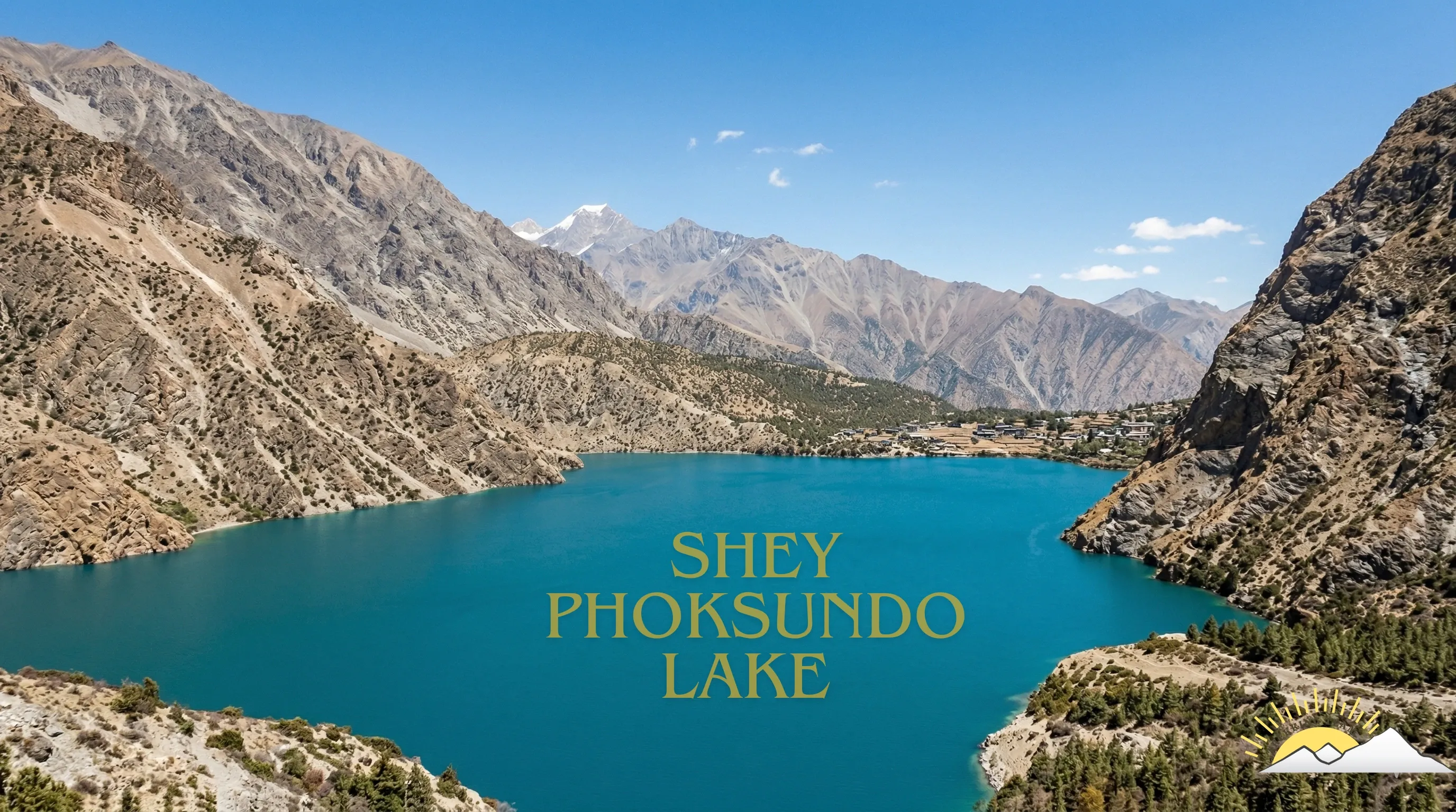
The Upper Dolpo Trek is a 24-day expedition starting and finishing in Kathmandu. The high point is Nengla La at 5,390 m, a normal day is 6 to 7 hours of walking, and from Phoksundo onwards it is a full camping trip with our own kitchen crew. There are no lodges north of the lake.
The route crosses Kang La at 5,360 m to reach Shey Gompa, the eleventh-century monastery beneath the Crystal Mountain that Peter Matthiessen walked to in 1973. From Shey it continues north to Bhijer, crosses Nengla La, and turns south through Saldang and Namdo before dropping into the Tarap valley and out through the gorge to Dunai.
What you are walking through is Tibetan in everything but passport. The villages farm barley at 4,000 m, the monasteries are Bon and Nyingma, and the trade routes over the passes to the north have run for centuries. Upper Dolpo stayed closed to foreigners until 1989 and the permit is still expensive precisely because access is limited.
This is one of the hardest trips we run. Fourteen nights above 3,900 m, two passes above 5,350 m, a camping section with no road and no bail-out, and a flight at either end that cancels for weather. You need recent high-altitude experience and the time to absorb delays.
Trip Summary
Duration
Difficulty
Max Elevation
Start point
End point
Daily Activity
Group Size
Best Season
Trip Outline
- Day 1Arrival in Kathmandu
- Day 2Kathmandu: permits and preparation
- Day 3Kathmandu to Nepalgunj
- Day 4Fly to Juphal and trek to Dunai
- Day 5Dunai to Chhepka
- Day 6Chhepka to Rechi
- Day 7Rechi to Ringmo and Phoksundo Lake
- Day 8Acclimatisation at Phoksundo Lake
- Day 9Ringmo to Phoksundo Khola
- Day 10Phoksundo Khola to Snowfields Camp
- Day 11Cross Kang La to Shey Gompa
- Day 12Shey Gompa and the Crystal Mountain
- Day 13Shey Gompa to Bhijer
- Day 14Bhijer to Nengla High Camp
- Day 15Cross Nengla La to Saldang
- Day 16Saldang to Namdo
- Day 17Namdo to Sisaul
- Day 18Sisaul to Dho Tarap
- Day 19Rest day at Dho Tarap
- Day 20Dho Tarap to Laisicap
- Day 21Laisicap to Dunai
- Day 22Dunai to Juphal
- Day 23Fly Juphal to Nepalgunj and on to Kathmandu
- Day 24Departure
Included
- Full camping setup from Phoksundo Khola onwards: two-person tents, dining tent, kitchen tent, toilet tent, mattresses and all camp equipment
- All meals on the trek, breakfast, lunch and dinner, cooked by our own kitchen crew
- Cook and full kitchen crew, pack animals and handlers for camp loads
- Teahouse accommodation on the Suli Gad and Dunai sections, twin share
- Upper Dolpo restricted area permit, Lower Dolpo permit and Shey Phoksundo National Park entry fee
- One contingency day built into the itinerary at Dho Tarap
- Airport pick-up and drop-off in a private vehicle
- Kathmandu hotel on bed and breakfast basis
- Kathmandu to Nepalgunj and Nepalgunj to Juphal flights, and the return
- One night in Nepalgunj with breakfast on the outbound leg
- All restricted area permits and national park entry fees
- Government-licensed English-speaking guide, a long-term team member rather than a freelancer
- Porters or pack animals for your duffel, with their insurance, wages, food and equipment
- Staff insurance, domestic flights and transfers for the crew
- Comprehensive first aid kit, pulse oximeter and a satellite communication device carried by the guide
- Trekking Team duffel bag and route map
- All government and local taxes
Not Included
- International flights to and from Kathmandu
- Nepal visa, available on arrival at Kathmandu airport
- Travel insurance, which must cover helicopter evacuation above 5,000 m and is compulsory on this trip
- Lunches and dinners in Kathmandu and Nepalgunj
- Personal trekking equipment, sleeping bag and down jacket, both available to rent in Kathmandu
- Supplementary oxygen, which is always an extra and never included
- Drinks, snacks bought on the trail, hot showers and device charging
- Tips for the guide and crew
- Any cost arising from a flight delay, early return or evacuation
Get started on your journey
Detailed itinerary
Arrival in Kathmandu
Airport transfer, hotel, and an evening briefing with a full kit check. Upper Dolpo is a camping expedition and the gear list is longer than a teahouse trek.
Altitude: 1,400 m.
Travel duration
Elevation
Meal
Accommodation
Kathmandu: permits and preparation
Your Upper Dolpo restricted area permit is processed today and needs your original passport. The morning is free for Boudhanath or Patan; the afternoon is for hiring or buying anything still missing.
Altitude: 1,400 m.
Travel duration
Elevation
Meal
Accommodation
Kathmandu to Nepalgunj
Flight to the Terai and an overnight near the airport. Final repack for the Juphal weight limit.
Altitude: 150 m. Flight: about 1 hour.
Travel duration
Elevation
Meal
Accommodation
Fly to Juphal and trek to Dunai
Into the Bheri gorge by small aircraft, then down to the river and up to Dunai.
Altitude: 2,140 m. Distance: 4 km. Walking: 2 to 3 hours.
Travel duration
Elevation
Meal
Accommodation
Dunai to Chhepka
Up the Suli Gad through the park checkpost at Sulighat, climbing gently through pine and walnut into the gorge.
Altitude: 2,670 m. Distance: 14 km. Walking: 5 to 6 hours.
Travel duration
Elevation
Meal
Accommodation
Chhepka to Rechi
A steeper day beside the river, past the waterfall, with birch replacing pine as you climb.
Altitude: 3,110 m. Distance: 13 km. Walking: 5 to 6 hours.
Travel duration
Elevation
Meal
Accommodation
Rechi to Ringmo and Phoksundo Lake
The steep spur to the 3,780 m ridge, the first sight of the lake, and the drop into Ringmo.
Altitude: 3,640 m. Distance: 5 km. Walking: 3 to 4 hours.
Travel duration
Elevation
Meal
Accommodation
Acclimatisation at Phoksundo Lake
A rest day that is not a rest day. We walk a few hundred metres above the lake and come back down, and you spend the afternoon at Thasung Tsholing or on the shore.
Everything after tomorrow is above 3,700 m and mostly above 4,300 m. This day matters.
Altitude: 3,640 m. Walking: 3 to 4 hours.
Travel duration
Elevation
Meal
Accommodation
Ringmo to Phoksundo Khola
The famous section: the trail cut into the cliff above the western shore, narrow, exposed and built on stacked stone in places. Then the ground flattens into the meadow at the head of the lake.
Camp is on the flats by the Phoksundo Khola. This is the last easy night before the pass.
Altitude: 3,700 m. Distance: 10 km. Walking: 5 to 6 hours.
Travel duration
Elevation
Meal
Accommodation
Phoksundo Khola to Snowfields Camp
A long climb up a side valley with nearly 950 m of gain, following a stream to a high camp below the pass. Blue sheep are common on these slopes and snow leopards are not, whatever the brochures say.
Altitude: 4,635 m. Distance: 9 km. Walking: 6 to 7 hours.
Travel duration
Elevation
Meal
Accommodation
Cross Kang La to Shey Gompa
The big one. Kang La at 5,360 m is a steep pull on scree and the descent on the far side is just as steep, down into the Shey valley with the Crystal Mountain ahead.
Shey Gompa sits where two rivers meet, a red-walled monastery founded in the eleventh century. Arriving here on foot after ten days is the point of the whole trip.
Altitude: 4,340 m. Pass: Kang La, 5,360 m. Distance: 10 km. Walking: 6 to 7 hours.
Travel duration
Elevation
Meal
Accommodation
Shey Gompa and the Crystal Mountain
A full day at Shey. The kora around Crystal Mountain is the pilgrimage circuit that gives the place its meaning, and it takes most of a day at this altitude.
The mountain is quartz-veined and the rock really does glitter. Pilgrims walk the circuit clockwise in summer; we do the same.
Altitude: 4,340 m. Walking: 4 to 6 hours.
Travel duration
Elevation
Meal
Accommodation
Shey Gompa to Bhijer
North and east over rolling high ground, then a long descent to Bhijer, a village of flat roofs stacked against the hillside with a gompa above it.
Altitude: 3,855 m. Distance: 18 km. Walking: 6 to 7 hours.
Travel duration
Elevation
Meal
Accommodation
Bhijer to Nengla High Camp
A hard climb to a high, cold camp below the second big pass. There is no water for the last stretch, so the crew carries it up.
Altitude: 4,880 m. Distance: 7 km. Walking: 5 to 6 hours.
Travel duration
Elevation
Meal
Accommodation
Cross Nengla La to Saldang
Nengla La at 5,390 m is the highest point of the trek. The view north runs into Tibet across a landscape with almost nothing green in it.
The descent to Saldang is long. Saldang is the largest village in Upper Dolpo, strung along a terrace above the river with barley fields and a lot of chortens.
Altitude: 4,050 m. Pass: Nengla La, 5,390 m. Distance: 12 km. Walking: 7 to 8 hours.
Travel duration
Elevation
Meal
Accommodation
Saldang to Namdo
A gentler day south along the Nam Khong river past chortens and mani walls, through Namdo, a scattered settlement with a monastery and a long history of salt trading with Tibet.
Altitude: 4,100 m. Distance: 14 km. Walking: 5 to 6 hours.
Travel duration
Elevation
Meal
Accommodation
Namdo to Sisaul
Continuing south down the valley, losing height slowly, with the trail high above the river for much of the day.
Altitude: 3,900 m. Distance: 15 km. Walking: 6 hours.
Travel duration
Elevation
Meal
Accommodation
Sisaul to Dho Tarap
Over a low pass and into the Tarap valley, wide and flat after two weeks of gorges and high ground.
Altitude: 4,090 m. Distance: 13 km. Walking: 6 to 7 hours.
Travel duration
Elevation
Meal
Accommodation
Rest day at Dho Tarap
A day in the valley. Ribo Bhumpa and Shipchhok gompas are both walkable, one Buddhist and one Bon, and the contrast is the clearest lesson in Dolpo religion you will get.
This is also the contingency day. If weather cost us a day earlier, it is spent here.
Altitude: 4,090 m.
Travel duration
Elevation
Meal
Accommodation
Dho Tarap to Laisicap
The long drop into the Tarap gorge, nearly 1,500 m of descent on an exposed trail built out from the cliff in places. A big day for the knees.
Altitude: 2,600 m. Distance: 22 km. Walking: 7 to 8 hours.
Travel duration
Elevation
Meal
Accommodation
Laisicap to Dunai
Out of the gorge and down the Thuli Bheri to Dunai. The first proper village in a fortnight, with shops and a lodge bed.
Altitude: 2,090 m. Distance: 23 km. Walking: 6 to 7 hours.
Travel duration
Elevation
Meal
Accommodation
Dunai to Juphal
A short last walk and the climb to the airstrip.
Altitude: 2,475 m. Distance: 10 km. Walking: 3 hours.
Travel duration
Elevation
Meal
Accommodation
Fly Juphal to Nepalgunj and on to Kathmandu
Morning flight out of the hills and a connection to Kathmandu.
Altitude: 1,400 m.
Travel duration
Elevation
Meal
Accommodation
Departure
Transfer to the airport for your onward flight.
Altitude: 1,400 m.
Travel duration
Elevation
Meal
Accommodation
Ready to start your journey?
Start planning your dream trip today. Enquire now for more information or customize this trip to tailor it to your needs and make it truly unforgettable.