By Trekking Team, Kathmandu | Updated 17 November 2026 | 9 minute read
Quick answer: Day 2 of the Everest Base Camp trek takes you from Phakding (2,610 m) to Namche Bazaar (3,440 m). That is roughly 10 km on foot, 5 to 7 hours with stops, and a net climb of about 830 m. You follow the Dudh Koshi river through pine forest, cross several suspension bridges, pass the Sagarmatha National Park gate at Monjo, and finish with a long, steep climb after the Hillary Bridge. It is the first real test of the trek, and it ends in the liveliest town in the Khumbu.
Day 1 is gentle on purpose. You land at Lukla, walk down a river valley and sleep lower than the airstrip. Day 2 is where the mountains start asking for something back.
We wrote this guide for people who want to know exactly what the day feels like before they commit to it: where the trail climbs, where it flattens, what the permit officers check and how to reach Namche in good shape. Where published sources disagree, and on this section they often do, we say so.
Everest Base Camp trek Day 2 at a glance
| Start | Phakding, 2,610 m |
| End | Namche Bazaar, 3,440 m |
| Net climb | About 830 m |
| Distance | Roughly 10 km (published figures run from 7.4 to 10.5 km) |
| Walking time | 5 to 7 hours including breaks |
| Permits checked | Sagarmatha National Park gate at Monjo, and again at Namche |
| Biggest effort | The climb after the Hillary Bridge, about two hours |
| Tomorrow | Acclimatisation day in Namche |
Some operators count the arrival day in Kathmandu as Day 1, which makes this walk Day 3 or even Day 4 on their itineraries. Here, Day 2 means the second day on the trail, the one right after the Lukla flight.
What is the route from Phakding to Namche Bazaar?
You leave Phakding after an early breakfast and the river is already beside you. For the first few hours the path rolls along the valley, dipping to bridges and rising again, with small villages, mani walls and tea stops every half hour or so. The big climbing waits until the afternoon.
| Stage | Approx. elevation | What to expect |
|---|---|---|
| Phakding | 2,610 m | Start. The first bridge crossing comes almost at once. |
| Tok Tok and Benkar | 2,650 to 2,700 m | Rolling trail above the Dudh Koshi, more bridges, quiet stretches. |
| Chumoa and Monjo | About 2,800 m | Monjo holds the Sagarmatha National Park gate, where permits are checked. |
| Jorsale | 2,750 to 2,800 m | The last village before the climb, and the usual lunch stop. |
| Hillary Bridge | Just above Jorsale | A high suspension bridge near the meeting of the Bhote Koshi and the Dudh Koshi. |
| Namche Bazaar | 3,440 m | A zigzag climb through pine forest, then a check post just below town. |
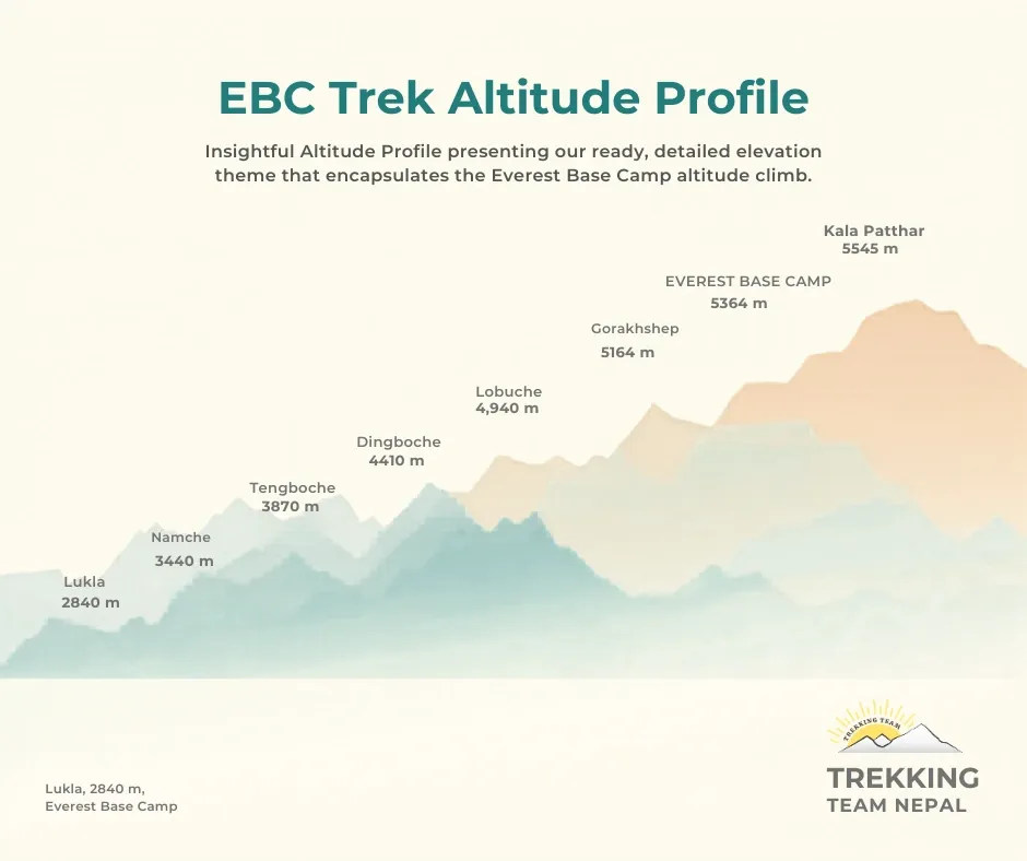
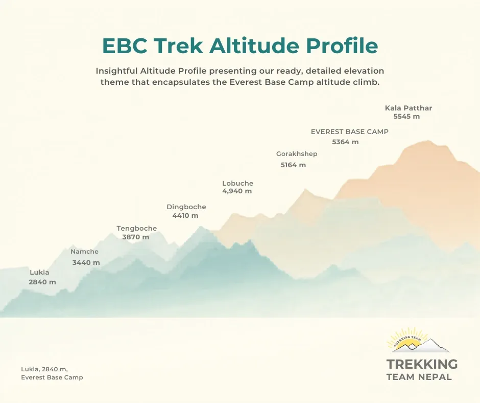
Elevations vary by 50 to 100 m between sources, so treat the table as a guide. The pattern is what matters. From Phakding to Monjo you gain only about 200 m. The remaining 600 m or more arrives after Jorsale. That is why the day feels easy for hours and then does not.
How long does each part of Day 2 take?
| Section | Approximate time |
|---|---|
| Phakding to Benkar | 45 to 60 minutes |
| Benkar to Monjo | 45 to 60 minutes |
| Monjo to Jorsale | 30 to 45 minutes |
| Jorsale to Hillary Bridge | Varies with pace and bridge traffic (about 2 km) |
| Hillary Bridge to Namche | Around 2 hours |
These are illustrative estimates, not guaranteed timings. Your pace, your photo stops and the queue of yak trains and groups on the bridges will all move them. Add the Jorsale stretch and the sections come to roughly four to five hours of walking. Lunch and rest stops stretch that into the 5 to 7 hour day described above.
Editor note (delete before publishing): have an experienced Trekking Team guide check these timings before this goes live.
How hard is the Phakding to Namche Bazaar trek?
Harder than Day 1 and easier than people fear, though almost everyone arrives tired. The distance is modest. The difficulty comes from the last climb and from the altitude it carries you into.
Published distances for this day run from 7.4 km to 10.5 km, and walking times from 4 hours to 7. Both ranges make sense. The trail twists, GPS tracks of it never quite agree, and a fit trekker with a light daypack moves a lot faster than a first-timer who stops for every photograph. Plan for 5 to 7 hours and you will be right more often than not.
Fitness helps, but patience helps more. Sherpa guides say bistare, bistare, which means slowly, slowly, and they mean it. Take the climb at a pace where you could still hold a conversation. Stop when your breathing runs ahead of you, sip water, then go again. People who race the climb often arrive with a headache. People who plod arrive smiling.
Which permits are checked on Day 2?
Foreign trekkers on the standard Everest Base Camp route need two permits: the Sagarmatha National Park entry permit (NPR 3,000, with 13% VAT added at most counters) and the Khumbu Pasang Lhamu Rural Municipality fee, which most current sources put at NPR 3,000. Older pages still quote NPR 2,000 for the municipality fee, so confirm the figure at the counter. SAARC nationals pay reduced rates.
The municipality fee is collected at Lukla or Monjo, and the park permit can be bought in Kathmandu or at the Monjo gate. Officers check them at Monjo and again at the check post below Namche, so carry the originals, not photocopies. The TIMS card is not used in the Everest region. The municipality permit replaced it here, though TIMS is still required on other treks in Nepal.
If you travel with an operator, your guide handles the paperwork. Fees change, so check the publication date on any permit guide, including this one.
How do you handle altitude on the way to Namche?
Day 2 is a big step up in sleeping altitude. You go to bed at 2,610 m in Phakding and the next night at 3,440 m in Namche, a jump of about 830 m. Mountain medicine guidelines, including the CDC Yellow Book and the Wilderness Medical Society, advise adding no more than about 500 m of sleeping elevation a night once you are above 3,000 m, with an extra night of rest for every 1,000 m gained. Namche is the first night above 3,000 m on this trek, so the jump runs a little faster than the guideline. That is why every sensible itinerary puts a rest day in Namche straight after this walk. Sleeping altitude counts for more than the highest point you reach during the day.
Headache is the usual first sign of acute mountain sickness, sometimes with nausea, unusual tiredness or a poor night's sleep. Mild symptoms mean you stop climbing and rest until they clear. A worsening headache, vomiting, confusion, wobbling when you walk, or breathlessness while resting mean you tell your guide at once and go down. Never go higher to sleep while you have symptoms.
Drink steadily through the day, because dehydration looks a lot like altitude sickness, and leave the alcohol until after the trek. If you are wondering about preventive medication such as acetazolamide, ask a doctor before you travel. It is a prescription decision, not a packing-list item.
What are the Hillary Bridge and the other bridges like?
You will cross about five suspension bridges today, and the Hillary Bridge is the one everyone remembers. It hangs high above the river where the Bhote Koshi and the Dudh Koshi meet, close to the start of the final climb. Ask five guides how high it is and you will hear five answers. Websites quote anything from 70 m to 135 m. Whatever the true number, the bridge is long enough to sway, busy enough that you will wait your turn, and an older bridge still hangs beneath it.
On the bridges and on the trail, yaks and porters have right of way. When a yak train comes through, step to the hillside, never the drop side, and wait. The animals are surprisingly wide. Pass mani walls, stupas and prayer wheels on the left, so you walk around them clockwise.
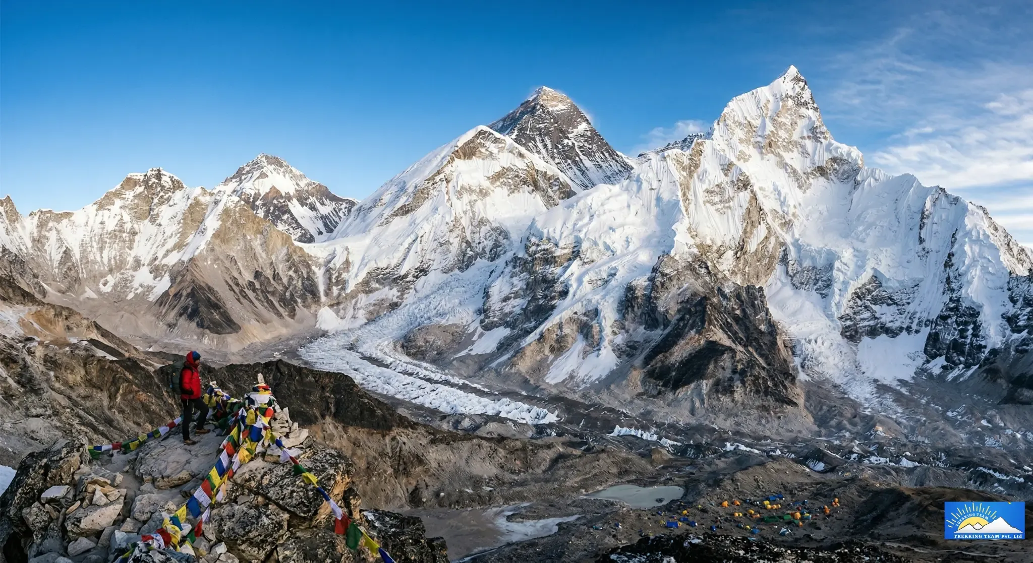
If the cloud allows, the climb gives you a first glimpse of Everest and a good look at Thamserku across the valley. Plenty of trekkers see nothing on their first try, and that is normal. Namche's higher viewpoints give you another chance.
How guides manage Day 2 on the Phakding to Namche trail
The final climb catches people out because of what comes before it. The first four or five hours feel like a river walk, so many trekkers spend them at full speed. Then the trail turns uphill and stays that way, at altitude, on tired legs. Those who rushed the morning feel it most.
Groups rarely stay together on the climb. Faster walkers pull ahead, others settle into a slower rhythm, and a gap of half an hour can open up. Good practice is a guide near the front and another person behind the slowest walker, so everyone stays within reach of someone who knows the way.
An early start is standard advice. It keeps the climb out of the afternoon cloud, avoids the crush on the bridges when yak trains and large groups arrive, and gets you into Namche with daylight left to find a room and rest.
When a trekker develops a headache or nausea, the guide slows the group and watches how the person walks and talks. Mild symptoms mean no further climbing until they clear. Anything worse means going down.
At the Hillary Bridge the guide usually sends people across in small batches, watches for yak trains coming from the other side and holds the group back until the bridge clears. It is a place to wait your turn, not to stop for a long photo.
What should you eat, drink and carry?
Eat a proper lunch at Monjo or Jorsale before the climb, because there is little on the slope above. Many trekkers choose vegetarian food such as dal bhat on the trail, since supplies reach the higher lodges on porters' backs.
Your duffel travels separately with the porters, so your daypack only needs the day's essentials:
- Water, at least a couple of litres, and a few snacks
- A warm layer and a waterproof shell, even on a sunny morning
- Sun hat, sunglasses and sunscreen
- Trekking poles, which save your knees on the bridges and the climb
- Original permits and some Nepali rupees in cash
How does the season change Day 2?
October and November bring the clearest skies and cold mornings, which is why the trail is busy then. March to May is warmer and a little hazier. The monsoon, June to August, brings rain, mud, cloud that hides the views and more flight delays. In winter the days are crisp, the trail is quieter and shaded stretches can hold ice.
What is Namche Bazaar like when you arrive?
Namche is a surprise after two days of villages. It is the administrative centre of the Khumbu, built into a bowl-shaped hillside, with the Sagarmatha National Park headquarters, a police check post, army barracks, banks and ATMs, bakeries and gear shops. The park visitor centre and its small Sherpa museum sit at the top of town. A weekly market runs on Saturday.
ATMs in the Khumbu can be unreliable, so bring enough rupees from Kathmandu. Wi-Fi and phone charging at lodges usually cost extra. Drink water, eat something warm and go to bed early. Tomorrow is a rest day, which in practice means a short walk high and a night back at 3,440 m. That habit of climbing high and sleeping low is what makes the rest of the trek work.
What if your Lukla flight changes Day 2?
From late September to the end of November, and again from late March to the end of May, Lukla flights depart from Manthali Airport in Ramechhap, a four to five hour drive east of Kathmandu, instead of from Kathmandu itself. Dates shift by a week or two each year, so confirm them with your operator. Weather can hold flights for a day or more, and when your flight slips, Day 2 slips with it. Keep a spare day or two at the end of any itinerary.
Baggage on the Lukla flight is limited to 15 kg per person in total, a 10 kg duffel plus 5 kg of hand carry. Anything extra stays in storage in Kathmandu. For current road, flight and trail conditions, see our Nepal travel advisory.
Walk Day 2 as part of our full Everest Base Camp itinerary
Day 2 only makes sense as one step in a longer plan. Our full Everest Base Camp trek itinerary is built around it: the rest day in Namche comes straight after this walk, so the 830 m jump in sleeping altitude is followed by a night to settle before you climb higher.
A licensed guide leads your group, sets the pace and watches for altitude symptoms, and can slow the day down or turn people around when needed. We arrange your Sagarmatha National Park and Khumbu permits, so the checks at Monjo and Namche are a formality rather than a queue, and we book your teahouse rooms along the route, including in Namche, where beds fill fast in autumn and spring.
Trekking Team has operated treks in Nepal since 1991 and is registered with TAAN (#1106). We have guided more than 10,000 trekkers and hold over 630 reviews on TripAdvisor. Tell us your dates and fitness level at trekkingteam.com and we will tell you whether this itinerary suits you. Our office is in Gongabu, Pragatinagar, Kathmandu.
Editor note (delete before publishing): I could not verify these service claims from your records: a Namche rest day in the itinerary, guides turning people around, Trekking Team arranging both permits, and booking Namche teahouses. Confirm each, and replace the first link with the live itinerary URL.
Frequently asked questions about Everest Base Camp trek Day 2
How long is the Phakding to Namche Bazaar trek?
Plan 5 to 7 hours of walking, including stops. Published distances range from about 7.4 km to 10.5 km, so 10 km is a sensible planning figure. The last climb after the Hillary Bridge takes about two hours.
How high is Namche Bazaar?
Namche Bazaar sits at about 3,440 m (11,290 ft), roughly 830 m above Phakding.
Is Day 2 harder than Day 1?
For most trekkers, yes. Day 1 is a short walk that ends lower than the Lukla airstrip. Day 2 adds about 830 m of net climb, most of it after Jorsale.
Which permits do I need on Day 2?
Foreign trekkers need the Sagarmatha National Park permit (NPR 3,000 plus VAT) and the Khumbu Pasang Lhamu Rural Municipality fee (most current sources say NPR 3,000). Both are checked at Monjo and Namche. TIMS is not used in the Everest region.
Can you see Everest on the walk to Namche?
Sometimes. On clear days the climb above the Hillary Bridge gives a first glimpse of Everest, but cloud often hides it. Namche's higher viewpoints give another chance.
What should I do if I get a headache on Day 2?
Stop climbing, rest, drink water and tell your guide. If symptoms worsen, or you feel confused, unsteady or breathless at rest, descend. Never go higher to sleep while you have symptoms.
Do I need a guide for this section?
Everest is an open route, so a guide is not a legal requirement here. We still recommend one, because trail junctions, weather and altitude decisions are easier with someone who knows the route.